This is a program to manipulate digital (raster) maps and their calibrations. It is not designed to handle vector maps nor to handle encypted images.
Features:
- Load map images and calibrate them
- Load calibrations in many different formats and Datums
- View the calibrated map
- Crop and rescale maps whilst preserving the calibration
- Reproject maps to 'Plate Carre' (Equirectangular)
- Rotate maps to true North
- Fit maps to other projections and polynomial fit
- Read and Write Garmin Custom Maps (KMZ) and Write Trekbuddy Maps
- Read MrSID .sid and .jp2 files
- Merge, join or overlay maps regardless of the scale or projection
- Draw tracks and routes onto maps
- Write several calibration formats
- Write Mobile Atlas tile sets for Andnav, Maverick, Back Country Navigator, Orux and
OSM Tracker. Also Locus, AlpineQuest, Rmaps and MyTrails
- Write map sets for Trekbuddy
- Write map and OZF2 image for Androzic or OZI CE
- Comes with a library of 100 datums (thanks to GPSU)
- User-definable grids for Transverse Mercator, Lambert and Albers projections

It allows you manage the data from your Android device using your PC.

It is a program that enables VMLite VNC Server on non-rooted Android devices.
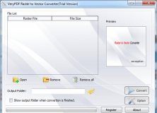
Raster to Vector Converter is used to convert raster files to vector files.

It allows you to transfer Android SMS to PC and SMS from Android to Android.


Comments (1)
Supports a hell of different output formats, can convert a lot of different maps, can georeference a map and, as a special, you can merge several maps to one big map.
For me, best of breed!